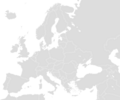
Fix:Blank map Europe with borders.png

Grandia de esta previde: 719 × 600 pixeles Otra densias: 288 × 240 pixeles | 576 × 480 pixeles | 921 × 768 pixeles | 1,200 × 1,001 pixeles.
Fix orijinal (1,200 × 1,001 pixeles, grandia de fix: 50 KB, tipo MIME: image/png)
Istoria de fix
Clica un data/ora per vide la fix en sua forma de alora.
| Data/Ora | Imajeta | Mesuras | Usor | Comenta | |
|---|---|---|---|---|---|
| aora | 17:42, 21 janero 2018 |  | 1,200 × 1,001 (50 KB) | Koreanovsky | Border fix: Bosnia and Herzegovina and Croatia |
| 13:03, 15 desembre 2011 |  | 1,200 × 1,000 (19 KB) | Mayhaymate | Optimized with PNGOUT | |
| 23:32, 18 april 2010 |  | 1,200 × 1,000 (24 KB) | Bernerd | Reverted to version as of 18:09, 7 August 2008 | |
| 14:44, 13 setembre 2008 |  | 1,200 × 1,000 (33 KB) | Avala | ||
| 18:09, 7 agosto 2008 |  | 1,200 × 1,000 (24 KB) | San Jose | ||
| 19:40, 19 julio 2006 |  | 1,200 × 1,000 (33 KB) | San Jose | * Description: Blank map of Europe * Source: Own map, based on the maps of [https://www.cia.gov/cia/publications/factbook/index.html The World Factbook] * Author: San Jose, 19. July 2006 {{PD-USGov-CIA-WF}} [[Category:Blank maps of Eur |
Usas de fix
No pajes lia a esta fix.
Usa global de fix
La otra vicis seguente usa esta fix:
- Usa en en.wiktionary.org
- Scotland
- Norveç
- Italia
- تركيا
- Europa
- Estland
- Türkiye
- ألمانيا
- Yunanistan
- Ermenistan
- روسيا
- इटली
- ترکی
- საქართველო
- Kıbrıs
- آئرلینڈ
- საფრანგეთი
- საბერძნეთი
- თურქეთი
- یونان
- Norþweg
- Finlandiya
- यूरोप
- इंग्लैंड
- एस्टोनिया
- Norweskô
- انگلستان
- برطانیہ
- ألبانيا
- आयरलैंड
- İspanya
- Bulgaristan
- İzlanda
- İskoçya
- Macaristan
- Almanya
- Avrupa
- Polonya
- Danimarka
- Belçika
- Avusturya
- Arnavutluk
- فرنسا
- Ukrajina
- İsviçre
- إنكلترا
- İngiltere
- İsveç
- Romanya
- Rusya
Mostra plu usas global de esta fix.


