Fix:Côte d'Ivoire Map.jpg
Grandia de esta previde: 470 × 600 pixeles Otra densias: 188 × 240 pixeles | 376 × 480 pixeles | 602 × 768 pixeles | 1,036 × 1,322 pixeles.
Fix orijinal (1,036 × 1,322 pixeles, grandia de fix: 440 KB, tipo MIME: image/jpeg)
| Descrive |
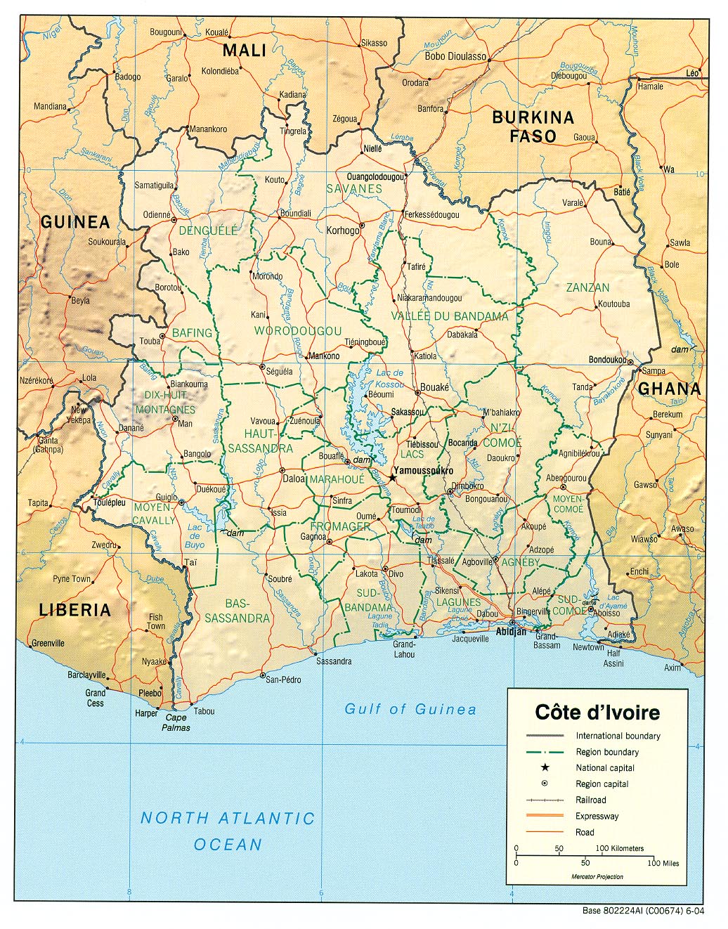
English: haded relief map of Côte d'Ivoire. |
|||
| Data | ||||
| Fonte | [1] from the Perry-Castañeda Library Map Collection. | |||
| Autor | CIA | |||
| Permete (Reusante esta fix) |
|

![[1]](http://www.lib.utexas.edu/maps/africa/cote_divoire_rel04.jpg)
Istoria de fix
Clica un data/ora per vide la fix en sua forma de alora.
| Data/Ora | Imajeta | Mesuras | Usor | Comenta | |
|---|---|---|---|---|---|
| aora | 11:11, 21 febrero 2006 | | 1,036 × 1,322 (440 KB) | Lupo | Shaded relief map of Côte d'Ivoire. Source: [http://www.lib.utexas.edu/maps/africa/cote_divoire_rel04.jpg] from the [http://www.lib.utexas.edu/maps/cote_d'ivoire.html Perry-Castañeda Library Map Collection]. {{PD-USGov-CIA}} [[Category:Maps of C� |
Usas de fix
La paje seguente lia a esta fix:
Usa global de fix
La otra vicis seguente usa esta fix:
- Usa en als.wikipedia.org
- Usa en ar.wikipedia.org
- Usa en az.wikipedia.org
- Usa en be.wikipedia.org
- Usa en bn.wikipedia.org
- Usa en ca.wikipedia.org
- Usa en ckb.wikipedia.org
- Usa en cv.wikipedia.org
- Usa en de.wikipedia.org
- Usa en en.wikipedia.org
- Usa en es.wikipedia.org
- Usa en fa.wikipedia.org
- Usa en fr.wikipedia.org
- Usa en fr.wikinews.org
- Usa en fy.wikipedia.org
- Usa en gd.wikipedia.org
- Usa en gl.wikipedia.org
- Usa en hi.wikipedia.org
- Usa en id.wikipedia.org
- Usa en it.wikipedia.org
- Usa en ka.wikipedia.org
- Usa en kbp.wikipedia.org
- Usa en kk.wikipedia.org
- Usa en mzn.wikipedia.org
- Usa en nl.wikipedia.org
- Usa en pl.wikipedia.org
- Usa en ru.wikipedia.org
Mostra plu usas global de esta fix.