Fix:Carte maine.svg

Grandia de esta previde PNG de esta fix SVG: 800 × 554 pixeles. Otra densias: 320 × 222 pixeles | 640 × 443 pixeles | 1,024 × 709 pixeles | 1,280 × 886 pixeles | 2,560 × 1,772 pixeles | 1,813 × 1,255 pixeles.
Fix orijinal (fix svg, densia: 1,813 × 1,255 pixeles, grandia: 3.76 MB)
Resoma
| Descrive |
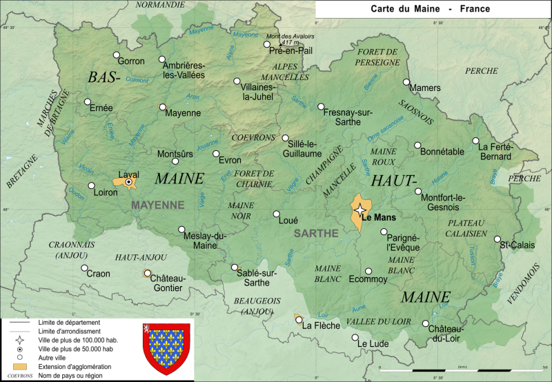
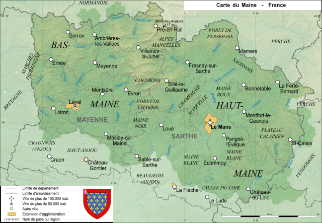
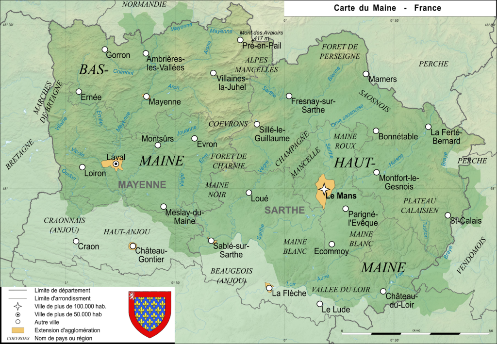
Carte de l'ancienne province française du Maine Map of the ancient french province Maine |
| Data | |
| Fonte | Obra propre |
| Autor | User:Esprit04 |
Lisensa
| I, the copyright holder of this work, release this work into the public domain. This applies worldwide. In some countries this may not be legally possible; if so: I grant anyone the right to use this work for any purpose, without any conditions, unless such conditions are required by law. |
Istoria de fix
Clica un data/ora per vide la fix en sua forma de alora.
| Data/Ora | Imajeta | Mesuras | Usor | Comenta | |
|---|---|---|---|---|---|
| aora | 12:27, 20 agosto 2021 | | 1,813 × 1,255 (3.76 MB) | Esprit04 | limites |
| 17:23, 5 febrero 2021 |  | 1,812 × 1,254 (3.41 MB) | Esprit04 | m | |
| 20:32, 4 febrero 2021 |  | 1,811 × 1,253 (3.38 MB) | Esprit04 | m | |
| 13:21, 1 febrero 2021 |  | 1,811 × 1,253 (3.38 MB) | Esprit04 | Meilleure version | |
| 21:03, 4 maio 2011 |  | 2,816 × 2,112 (64 KB) | VIGNERON | ||
| 11:00, 9 marto 2008 |  | 2,816 × 2,112 (72 KB) | Esprit04 | {{Information |Description=Carte de l'ancienne province française du Maine Map of the ancient french province Maine |Source=travail personnel |Date=09/03/2008 |Author= Koostia |Permission= |other_versions= }} Category:Sarthe[[Catego | |
| 10:36, 9 marto 2008 |  | 2,816 × 2,112 (72 KB) | Esprit04 | {{Information |Description=Carte de l'ancienne province française du Maine Map of the ancient french province Maine |Source=travail personnel |Date=09/03/2008 |Author= Koostia |Permission= |other_versions= }} Category:Sarthe[[Catego | |
| 10:36, 9 marto 2008 |  | 2,816 × 2,112 (72 KB) | Esprit04 | {{Information |Description=Carte de l'ancienne province française du Maine Map of the ancient french province Maine |Source=travail personnel |Date=09/03/2008 |Author= Koostia |Permission= |other_versions= }} Category:Sarthe[[Categor | |
| 10:34, 9 marto 2008 |  | 2,816 × 2,112 (72 KB) | Esprit04 | {{Information |Description=Carte de l'ancienne province française du Maine Map of the ancient french province Maine |Source=travail personnel |Date=09/03/2008 |Author= Koostia |Permission= |other_versions= }} Category:Sarthe[[Categor | |
| 10:28, 9 marto 2008 |  | 2,816 × 2,112 (72 KB) | Esprit04 | {{Information |Description=Carte de l'ancienne province française du Maine Map of the ancient french province Maine |Source=travail personnel |Date=09/03/2008 |Author= Koostia |Permission= |other_versions= }} Category:Sarthe[[Categor |
Usas de fix
La paje seguente lia a esta fix:
Usa global de fix
La otra vicis seguente usa esta fix:
- Usa en ca.wikipedia.org
- Usa en de.wikipedia.org
- Usa en en.wikipedia.org
- Usa en es.wikipedia.org
- Usa en fa.wikipedia.org
- Usa en fr.wikipedia.org
- Usa en he.wikipedia.org
- Usa en it.wikipedia.org
- Usa en nrm.wikipedia.org
- Usa en pt.wikipedia.org
- Usa en simple.wikipedia.org