Fix:Donrivermap.png
Grandia de esta previde: 595 × 599 pixeles Otra densias: 238 × 240 pixeles | 477 × 480 pixeles | 1,000 × 1,007 pixeles.
Fix orijinal (1,000 × 1,007 pixeles, grandia de fix: 209 KB, tipo MIME: image/png)

|
This map image could be re-created using vector graphics as an SVG file. This has several advantages; see Commons:Media for cleanup for more information. If an SVG form of this image is available, please upload it and afterwards replace this template with
{{vector version available|new image name}}.
It is recommended to name the SVG file “Donrivermap.svg”—then the template Vector version available (or Vva) does not need the new image name parameter. |
Resoma
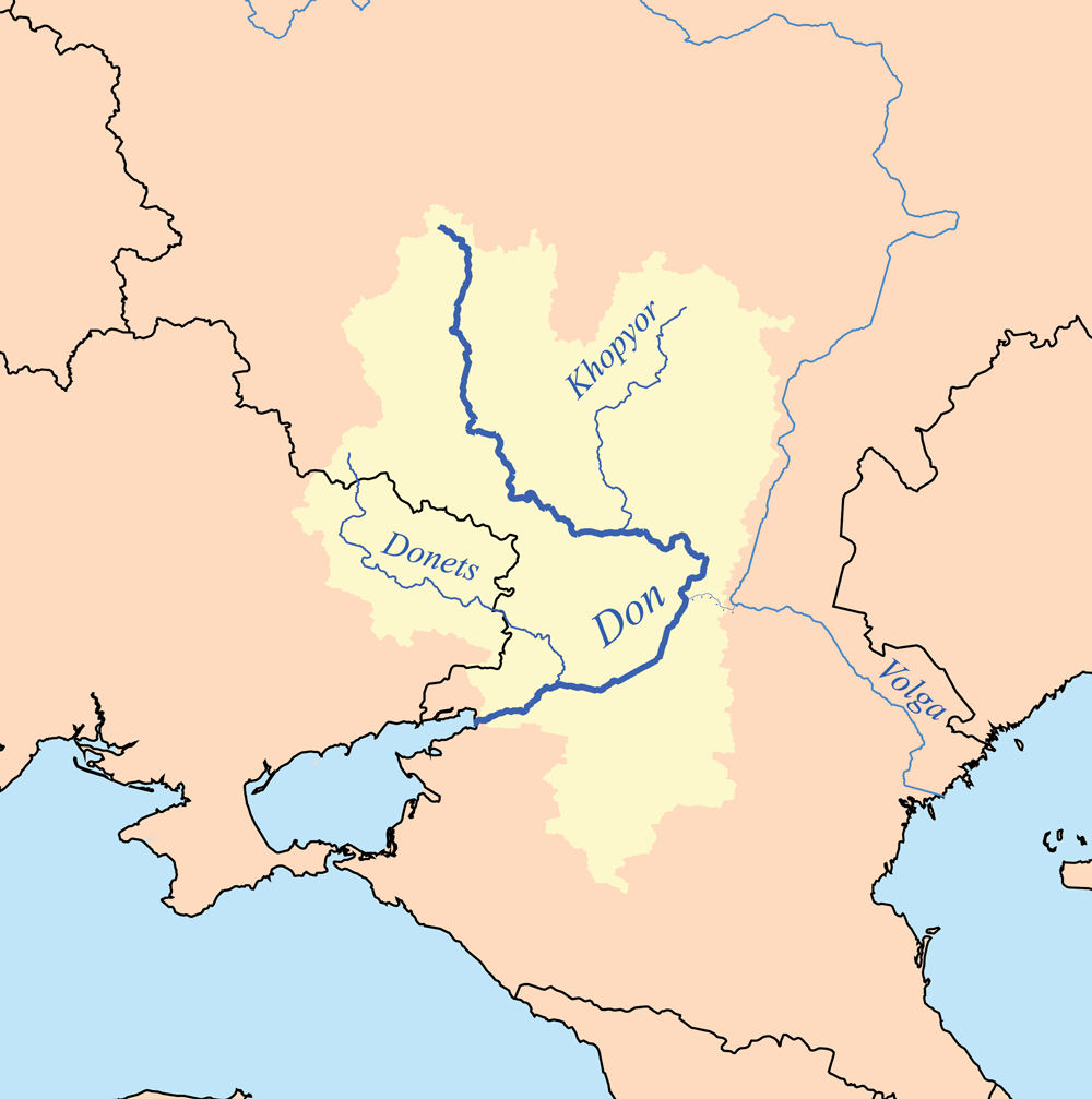
| Descrive | This is a map of the Don and Donets rivers. I, Karl Musser, created it based on USGS data. |
| Data | 18 setembre 2006 (original upload date) |
| Fonte | No machine-readable source provided. Own work assumed (based on copyright claims). |
| Autor | No machine-readable author provided. Kmusser assumed (based on copyright claims). |
Lisensa
I, the copyright holder of this work, hereby publish it under the following license:
This file is licensed under the Creative Commons Attribution-Share Alike 2.5 Generic license.
- Tu es libre:
- per comparti – per copia, distribui e transmete la obra
- per remisca – per ajusta la obra
- Su la constrinjes seguente:
- atribui – Tu debe atribui la obra en la modo spesifada par la autor o lisensor (ma no en cualce modo cual sujesta ce el aproba tu o tua usa de la obra).
- share alike – Si tu altera, muta o developa plu esta obra, tu pote distribui la obra resultante sola su la mesma lisensa o un simil a esta.
Istoria de fix
Clica un data/ora per vide la fix en sua forma de alora.
| Data/Ora | Imajeta | Mesuras | Usor | Comenta | |
|---|---|---|---|---|---|
| aora | 19:32, 2 febrero 2013 | | 1,000 × 1,007 (209 KB) | Kmusser | Upped resolution, added Khopyor |
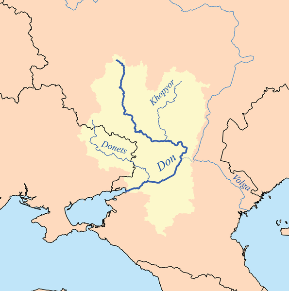
| 23:15, 18 setembre 2006 |  | 400 × 403 (66 KB) | Kmusser | This is a map of the Don and Donets rivers. I, Karl Musser, created it based on USGS data. {{self|cc-by-sa-2.5}} Category:Maps of rivers |
Usas de fix
La paje seguente lia a esta fix:
Usa global de fix
La otra vicis seguente usa esta fix:
- Usa en af.wikipedia.org
- Usa en am.wikipedia.org
- Usa en ar.wikipedia.org
- Usa en arz.wikipedia.org
- Usa en ast.wikipedia.org
- Usa en be-tarask.wikipedia.org
- Usa en be.wikipedia.org
- Usa en bh.wikipedia.org
- Usa en bn.wikipedia.org
- Usa en bo.wikipedia.org
- Usa en bs.wikipedia.org
- Usa en ca.wikipedia.org
- Usa en ceb.wikipedia.org
- Usa en cs.wikipedia.org
- Usa en cy.wikipedia.org
- Usa en da.wikipedia.org
- Usa en de.wikipedia.org
- Usa en dsb.wikipedia.org
- Usa en en.wikipedia.org
- Usa en eo.wikipedia.org
- Usa en eo.wiktionary.org
- Usa en es.wikipedia.org
- Usa en et.wikipedia.org
- Usa en fa.wikipedia.org
Mostra plu usas global de esta fix.