Fix:Europe Mediterranean Catalan Atlas.jpeg

Grandia de esta previde: 800 × 544 pixeles Otra densias: 320 × 218 pixeles | 640 × 435 pixeles | 1,024 × 696 pixeles.
Fix orijinal (1,024 × 696 pixeles, grandia de fix: 258 KB, tipo MIME: image/jpeg)
https://upload.wikimedia.org/wikipedia/commons/b/b1/Europe_Mediterranean_Catalan_Atlas.jpeg
Resoma
| Descrive |
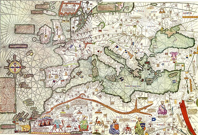
Català: Còpia del s. XX de l'Atlas Català de la Corona d'Aragó, de l'any 1375
Español: Mapa de Europa y el Mediterráneo, Copia del s. XX del Atlas Catalán de 1375.
English: Map of Europe and the Mediterranean from the copy to XX century of Catalan Atlas of 1375, second chart, first cartography.
Français : Atlas catalan (1375) : reconstitution de la partie occidentale de la carte, copie du XX° siècle.
Русский: Каталанский атлас (1375): западная часть карты, копия XX века.
Українська: Каталанський атлас - вершина каталонської школи середньовічної картографії. |
| Data | |
| Fonte | Unknown source |
| Autor | Reproduction of the Catalan Atlas of the 20th century that can not be considered facsimile of the original. |
| Other versions |
|

Lisensa
|
This is a faithful photographic reproduction of a two-dimensional, public domain work of art. The work of art itself is in the public domain for the following reason:
The official position taken by the Wikimedia Foundation is that "faithful reproductions of two-dimensional public domain works of art are public domain".
This photographic reproduction is therefore also considered to be in the public domain in the United States. In other jurisdictions, re-use of this content may be restricted; see Reuse of PD-Art photographs for details. | ||||
Istoria de fix
Clica un data/ora per vide la fix en sua forma de alora.
| Data/Ora | Imajeta | Mesuras | Usor | Comenta | |
|---|---|---|---|---|---|
| aora | 09:21, 30 marto 2006 | | 1,024 × 696 (258 KB) | Qasid | Map of Europe and the Mediterranean from the Catalan Atlas of 1375, second chart, first cartography. |
Usas de fix
La paje seguente lia a esta fix:
Usa global de fix
La otra vicis seguente usa esta fix:
- Usa en ar.wikipedia.org
- Usa en ast.wikipedia.org
- Usa en az.wikipedia.org
- Usa en be-tarask.wikipedia.org
- Usa en be.wikipedia.org
- Usa en bg.wikipedia.org
- Usa en bn.wikipedia.org
- Usa en ca.wikipedia.org
- Cartografia
- Edat mitjana
- Segle XIV
- 1375
- Corona d'Aragó
- Cronologia de la història de Catalunya
- Edat mitjana de Catalunya
- Usuari:Allman/art
- Història de Barcelona
- Jueus catalans
- Carta portolana
- Comerç català medieval
- Usuari:Mcapdevila/Història de la cartografia
- Usuari:Mcapdevila/Porto/Maps
- Edat mitjana als Països Catalans
- Història de la cartografia
- Escola cartogràfica mallorquina
- Viquiprojecte:Viquiestirada/Desembre
- Usa en cs.wikipedia.org
- Usa en de.wikipedia.org
- Usa en el.wikipedia.org
- Usa en en.wikipedia.org
- Usa en eo.wikipedia.org
- Usa en es.wikipedia.org
- Usa en eu.wikipedia.org
- Usa en fi.wikipedia.org
- Usa en fr.wikipedia.org
Mostra plu usas global de esta fix.