Fix:Kenya Map.png
Grandia de esta previde: 495 × 600 pixeles Otra densias: 198 × 240 pixeles | 396 × 480 pixeles | 1,002 × 1,214 pixeles.
Fix orijinal (1,002 × 1,214 pixeles, grandia de fix: 237 KB, tipo MIME: image/png)
| Descrive |
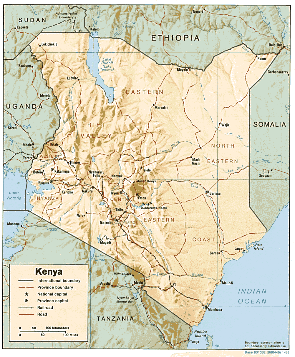
English: Shaded relief map of Kenya |
| Fonte | [1] from the Perry-Castañeda Library Map Collection |
| Autor | National Aeronautics and Space Administration |
| Other versions | Image:Kenya-relief-map-towns.jpg (enlarged town names) |
![[1]](http://www.lib.utexas.edu/maps/africa/kenya.gif)
| This image is a work of a Central Intelligence Agency employee, taken or made as part of that person's official duties. As a Work of the United States Government, this image or media is in the public domain in the United States.
|

|
Istoria de fix
Clica un data/ora per vide la fix en sua forma de alora.
| Data/Ora | Imajeta | Mesuras | Usor | Comenta | |
|---|---|---|---|---|---|
| aora | 13:17, 22 febrero 2006 | | 1,002 × 1,214 (237 KB) | Lupo | Shaded relief map of Kenya. Source: [http://www.lib.utexas.edu/maps/africa/kenya.gif] from the [http://www.lib.utexas.edu/maps/kenya.html Perry-Castañeda Library Map Collection]. {{PD-USGov-CIA}} Category:Maps of Kenya |
Usas de fix
La paje seguente lia a esta fix:
Usa global de fix
La otra vicis seguente usa esta fix:
- Usa en ar.wikipedia.org
- Usa en azb.wikipedia.org
- Usa en ban.wikipedia.org
- Usa en de.wikipedia.org
- Usa en el.wikipedia.org
- Usa en en.wikipedia.org
- Usa en es.wikipedia.org
- Usa en fr.wikipedia.org
- Usa en it.wikipedia.org
- Usa en ka.wikipedia.org
- Usa en os.wikipedia.org
- Usa en pl.wikipedia.org
- Usa en pt.wikipedia.org
- Usa en uk.wikipedia.org
- Usa en vec.wikipedia.org