Fix:Maseru from Parliament Hill.jpg

Grandia de esta previde: 800 × 533 pixeles Otra densias: 320 × 213 pixeles | 640 × 427 pixeles | 1,024 × 683 pixeles | 1,280 × 853 pixeles | 2,560 × 1,707 pixeles | 5,184 × 3,456 pixeles.
Fix orijinal (5,184 × 3,456 pixeles, grandia de fix: 2.09 MB, tipo MIME: image/jpeg)
Resoma
| Descrive |
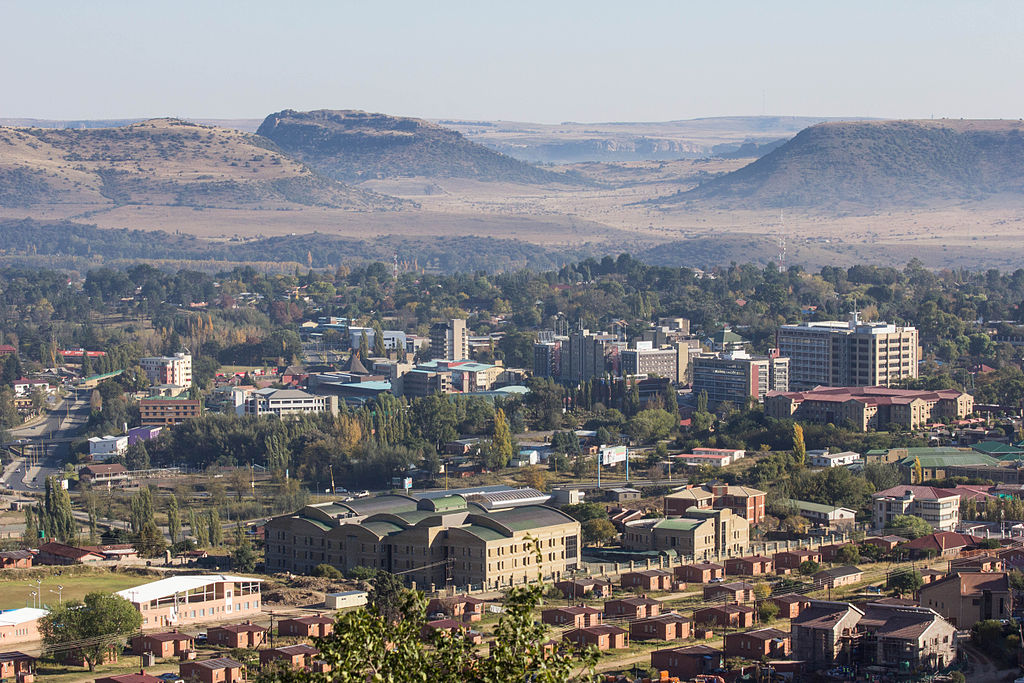
English: South African farmlands clearly visable across the river |
| Data | |
| Fonte | Flickr: Maseru from Parliament Hill |
| Autor | OER Africa |
| Camera location | | View this and other nearby images on: OpenStreetMap |
|---|
Lisensa
| This image was originally posted to Flickr by OER Africa at https://www.flickr.com/photos/47660417@N03/8700566641. It was reviewed on 11 marto 2015 by FlickreviewR and was confirmed to be licensed under the terms of the cc-by-2.0. |
This file is licensed under the Creative Commons Attribution 2.0 Generic license.
Atribui: OER Africa
- Tu es libre:
- per comparti – per copia, distribui e transmete la obra
- per remisca – per ajusta la obra
- Su la constrinjes seguente:
- atribui – Tu debe atribui la obra en la modo spesifada par la autor o lisensor (ma no en cualce modo cual sujesta ce el aproba tu o tua usa de la obra).
Istoria de fix
Clica un data/ora per vide la fix en sua forma de alora.
| Data/Ora | Imajeta | Mesuras | Usor | Comenta | |
|---|---|---|---|---|---|
| aora | 17:22, 11 marto 2015 | | 5,184 × 3,456 (2.09 MB) | Alifazal | User created page with UploadWizard |
Usas de fix
La paje seguente lia a esta fix:
Usa global de fix
La otra vicis seguente usa esta fix:
- Usa en af.wikipedia.org
- Usa en an.wikipedia.org
- Usa en ar.wikipedia.org
- Usa en arz.wikipedia.org
- Usa en ast.wikipedia.org
- Usa en be.wikipedia.org
- Usa en bn.wikipedia.org
- Usa en br.wikipedia.org
- Usa en bs.wikipedia.org
- Usa en ca.wikipedia.org
- Usa en ceb.wikipedia.org
- Usa en ce.wikipedia.org
- Usa en cs.wikipedia.org
- Usa en cy.wikipedia.org
- Usa en da.wikipedia.org
- Usa en de.wikipedia.org
- Usa en diq.wikipedia.org
- Usa en en.wikipedia.org
- Usa en en.wikivoyage.org
- Usa en es.wikipedia.org
- Usa en et.wikipedia.org
- Usa en eu.wikipedia.org
- Usa en fi.wikipedia.org
- Usa en fi.wikivoyage.org
- Usa en fr.wikipedia.org
- Usa en fr.wikivoyage.org
- Usa en ga.wikipedia.org
- Usa en gl.wikipedia.org
- Usa en gn.wikipedia.org
- Usa en hak.wikipedia.org
- Usa en ha.wikipedia.org
- Usa en he.wikipedia.org
- Usa en he.wikivoyage.org
- Usa en hi.wikipedia.org
- Usa en hr.wikipedia.org
- Usa en hsb.wikipedia.org
- Usa en ht.wikipedia.org
- Usa en ia.wikipedia.org
Mostra plu usas global de esta fix.