Fix:Netherlands Antilles-CIA WFB Map.png
No densia plu alta es disponable.
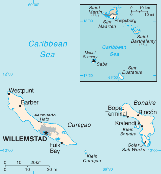
Netherlands_Antilles-CIA_WFB_Map.png (326 × 351 pixeles, grandia de fix: 8 KB, tipo MIME: image/png)
Resoma
| Descrive |
Español: Mapa Antillas Neerlandesas |
|||
| Data | ||||
| Fonte | CIA, The World Factbook, 2005 http://www.cia.gov/cia/publications/factbook/maps/nt-map.gif | |||
| Autor | CIA | |||
| Permete (Reusante esta fix) |
|

derivative works
Derivative works of this file:
Istoria de fix
Clica un data/ora per vide la fix en sua forma de alora.
| Data/Ora | Imajeta | Mesuras | Usor | Comenta | |
|---|---|---|---|---|---|
| aora | 22:44, 5 agosto 2010 | | 326 × 351 (8 KB) | Ras67 | cropped |
| 09:05, 30 janero 2006 |  | 329 × 353 (10 KB) | Hoshie | Updated map of the Netherlands Antilles from the CIA Factbook, 10 Jan 06 rev: http://www.cia.gov/cia/publications/factbook/maps/nt-map.gif | |
| 09:16, 27 marto 2005 |  | 329 × 354 (6 KB) | Wolfman~commonswiki | {{CIA-map}} |
Usas de fix
La paje seguente lia a esta fix:
Usa global de fix
La otra vicis seguente usa esta fix:
- Usa en cy.wikipedia.org
- Usa en en.wikipedia.org
- Usa en en.wikisource.org
- Usa en en.wiktionary.org
- Usa en es.wikipedia.org
- Usa en es.wikinews.org
- Usa en fa.wikipedia.org
- Usa en fi.wikipedia.org
- Usa en fr.wikipedia.org
- Usa en hu.wikipedia.org
- Usa en it.wikipedia.org
- Usa en lt.wikipedia.org
- Usa en mk.wikipedia.org
- Usa en no.wikipedia.org
- Usa en pl.wikipedia.org
- Usa en pl.wikivoyage.org
- Usa en pt.wikipedia.org
- Usa en ru.wikipedia.org
- Usa en sah.wikipedia.org
- Usa en sv.wikipedia.org
- Usa en th.wikipedia.org
- Usa en tr.wikipedia.org
- Usa en tr.wiktionary.org
- Usa en uk.wikipedia.org
- Usa en www.wikidata.org
- Usa en zh-min-nan.wikipedia.org