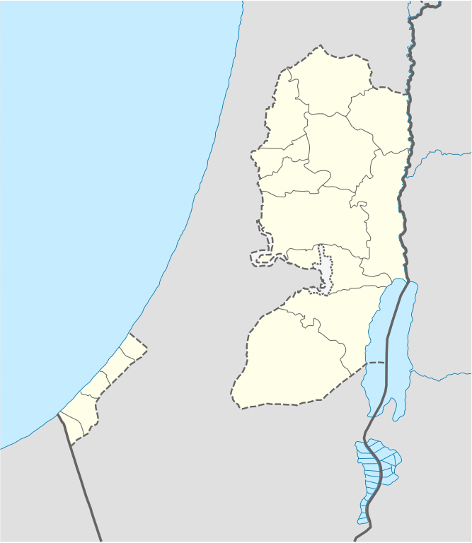
Fix:West Bank and Gaza Strip location map.svg

Grandia de esta previde PNG de esta fix SVG: 520 × 599 pixeles. Otra densias: 208 × 240 pixeles | 417 × 480 pixeles | 667 × 768 pixeles | 889 × 1,024 pixeles | 1,778 × 2,048 pixeles | 639 × 736 pixeles.
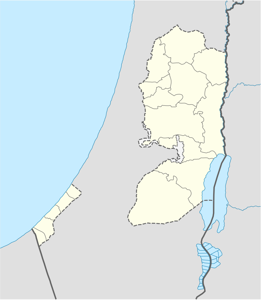
Fix orijinal (fix svg, densia: 639 × 736 pixeles, grandia: 98 KB)

|
The boundaries on this map show the de facto situation. This is just one of several different views on the subject (see COM:NPOV). |
Resoma
| Descrive |
Deutsch: Positionskarte der Palästinensische Autonomiegebiete bzw. von Westjordanland und Gazastreifen
Quadratische Plattkarte, N-S-Streckung 115 %. Geographische Begrenzung der Karte:
Equirectangular projection, N/S stretching 115%. Geographic limits of the map:
|
||
| Data | |||
| Fonte |
Own work using:
|
||
| Autor | NordNordWest | ||
| Other versions |
Derivative works of this file: |
||
| SVG genesis | This W3C-invalid map was created with Adobe Illustrator, and with Inkscape.
|

Lisensa
I, the copyright holder of this work, hereby publish it under the following licenses:

|
Permete es donada per copia, distribui e/o altera esta documento su la restrinjes de la GNU Free Documentation License, Varia 1.2 o cualce varia plu tarda publicida par la Free Software Foundation, sin partes nonvariante, sin testo de covrente fronte e sin testo de covrente retro. Un copia de la lisensa es incluida en la parte nomida GNU Free Documentation License. |
Esta fix es lisensada su la lisensa Attribution-Share Alike 3.0 Unported de Creative Commons.
- Tu es libre:
- per comparti – per copia, distribui e transmete la obra
- per remisca – per ajusta la obra
- Su la constrinjes seguente:
- atribui – Tu debe atribui la obra en la modo spesifada par la autor o lisensor (ma no en cualce modo cual sujesta ce el aproba tu o tua usa de la obra).
- share alike – Si tu altera, muta o developa plu esta obra, tu pote distribui la obra resultante sola su la mesma lisensa o un simil a esta.
Tu pote eleje la lisensa cual tu prefere
Istoria de fix
Clica un data/ora per vide la fix en sua forma de alora.
| Data/Ora | Imajeta | Mesuras | Usor | Comenta | |
|---|---|---|---|---|---|
| aora | 11:35, 28 april 2009 | | 639 × 736 (98 KB) | NordNordWest | area of West Bank back to correct position |
| 02:02, 28 april 2009 |  | 639 × 736 (109 KB) | Fjmustak | 0.85px solid governorate lines (consistent with Israel, Jordan, Lebanon, etc...) | |
| 18:58, 22 april 2009 |  | 639 × 736 (98 KB) | NordNordWest | corr | |
| 02:02, 17 april 2009 |  | 638 × 734 (119 KB) | Fjmustak | Added governorate boundaries | |
| 18:30, 29 novembre 2008 |  | 638 × 734 (103 KB) | NordNordWest | ||
| 20:05, 19 novembre 2008 |  | 638 × 734 (118 KB) | NordNordWest | {{Information |Description= {{de|Positionskarte der Palästinensischen Autonomiegebiete bzw. von Westjordanland und Gazastreifen}} Quadratische Plattkarte, N-S-Streckung 115 %. Geographische Begrenzung der Karte: |
Usas de fix
La paje seguente lia a esta fix:
Usa global de fix
La otra vicis seguente usa esta fix:
- Usa en af.wikipedia.org
- Usa en als.wikipedia.org
- Usa en an.wikipedia.org
- Usa en ar.wikipedia.org
- Usa en az.wikipedia.org
- Usa en ba.wikipedia.org
- Usa en be-tarask.wikipedia.org
- Usa en be.wikipedia.org
- Usa en bg.wikipedia.org
- Usa en bn.wikipedia.org
- Usa en ce.wikipedia.org
- Usa en ckb.wikipedia.org
- Usa en cs.wikipedia.org
Mostra plu usas global de esta fix.